Practical
Celestial Navigation (Maritime)
by Susan Peterson Howell
A comb-bound textbook/workbook praised by The Practical Sailor as "a
first-class piece of work", Susan Howell's Practical Celestial Navigation
was developed for Mystic Seaport's navigation courses. This third edition,
published by the Seaport's Planetarium, retains the step-by-step format
of the original, along with an abundance of diagrams and practice problems.
Practical Celestial Navigation is recommended as a self-instruction text
for beginners or for old celestial hands getting back in practice.
Spiral-bound from Mystic Seaport Museum
|
| |
Chapman Piloting & Seamanship 64th Edition
by Elbert S. Maloney, Charles Frederic Chapman
Listed under Seamanship
The
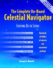
Complete On-Board Celestial Navigator
by George G. Bennett
Celestial navigation is an ancient skill, one that save lives when
electronics fail. But the conventional shipboard library requires six volumes
of sight reduction tables for world coverage, plus a star finder, an almanac,
and instructions, with the whole kit costing up to $300. For thousands
of sailors, The Complete On-Board Celestial Navigator is the perfect solution:
Just one handy volume has all the nautical almanac (40 pages) and sight
reduction (60 pages) information they are likely to need, good for 1999-2003,
plus instructions and a star finder. The publisher.
Spiral-bound - 176 pages Spiral edition (November 1,
)
McGraw-Hill Professional Publishing; ISBN: 0070071101
Celestial
Navigation in a Nutshell
by Hewitt Schlereth
In this guide, Schlereth draws on his experience as a sailor to explain
how to navigate any stretch of sea using only a hand-held sextant, a watch,
a plotting sheet, and a copy of the Nautical Almanac. The book offers instruction
on how to take sights by the sun, moon, stars and planets, and discusses
the advantages and disadvantages of each method. Common errors are reviewed,
and suggestions given for improving accuracy. Several examples and situational
illustrations are included. No bibliography.Book News, Inc.®,
Portland, OR
Celestial
Navigation for Yachtsmen
by Mary Blewitt, Thomas Bergel
(Paperback)
Celestial
Navigation by H. O. 249
by John E. Milligan
Celestial
Navigation by Jeff E. Toghill
Chisnell
on Instrument: Techniques
Mark Chisnell
Paperback / Book Published 1994
Chapman Piloting: Seamanship & Boat Handling
by Elbert S. Maloney, Charles Frederic Chapman
Listed under Seamanship
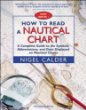
How
to Read a Nautical Chart : A Complete Guide to the Symbols, Abbreviations,
and Data Displayed on Nautical Charts
by Nigel Calder
Charts, whether paper or electronic, are your most fundamental navigational
tool. Using them to your best advantage requires a thorough understanding
of the symbols and abbreviations and an awareness of the limits of accuracy
in positions and soundings.
Did you know, for example, that hydrographic standards used to collect
the majority of data on modern charts are considerably less accurate than
GPS position fixes? That the majority of soundings still come from lead-line
surveys? That a wreck symbol surrounded by a dotted circle means it is
considered dangerous? That there are four different kinds of rock symbols,
each with a different meaning? And that the definition of "danger" has
changed over time and will depend on the age of your charts?
In How to Read a Nautical Chart, trusted boating authority Nigel Calder
answers these and hundreds of other questions clearly and concisely.
The
Publisher
Paperback from International Marine/Ragged Mountain Press
|
| |
The
Illustrated Longitude
by Dava Sobel, William J. H. Andrewes
This highly acclaimed book is essential reading for all who wish to
have a thorough understanding of the sea.
Hardcover - 216 pages illustrated edition (November )
Walker & Co; ISBN: 0802713440
International
Marine Light List and Waypoint Guide (The): Maine to Texas Including the
Bahamas
by John Kettlewell, Leslie Kettlewell, Paradise Cay Publications
Paperback from International Marine/Ragged Mountain Press
Latitude
Hooks and Azimuth Rings: How to Build and Use 18 Traditional Navigational
Instruments
by Dennis Fisher
Longitude
: The True Story of a Lone Genius Who Solved the Greatest Scientific Problem
of His Time
by Dava Sobel
The thorniest scientific problem of the eighteenth century was how
to determine longitude. Many thousands of lives had been lost at sea over
the centuries due to the inability to determine an east-west position.
This is the engrossing story of the clockmaker, John "Longitude" Harrison,
who solved the problem that Newton and Galileo had failed to conquer, yet
claimed only half the promised rich reward. Amazon.com
There is also a British film on the subject featuring Jeremy Irons and
a
stellar cast; a brilliant period piece which brings high drama to what
would outwardly appear a dry subject. It interleaves the story of the man
who discovered and restored the Harrison chronometers shortly after the
Great War with that of Harrison himself. Dropbears.com
Paperback - 184 pages Reprint edition
Penguin USA (Paper); ISBN: 0140258795
Navigation
Rules
by United States Coast Guard, US Coast Guard, John M. Morehouse, US
Coast Guard
Paperback from Paradise Cay Publications
The
Sextant Handbook : Adjustment, Repair, Use and History
by Bruce Bauer
Paperback - 192 pages 2nd edition (February 1, )
McGraw-Hill Professional Publishing; ISBN: 0070052190
GPS Navigation Systems
Global
Positioning Systems, Inertial Navigation, and Integration
by Mohinder S. Grewal, et al
Hardcover - 400 pages Book&Disk edition (December
)
John Wiley & Sons; ISBN: 047135032X
Fundamentals
of Global Positioning System Receivers: A Software Approach
by James Bao-Yen Tsui
(Hardcover)
GPS
Land Navigation: A Complete Guidebook for Backcountry Users of the NAVSTAR
Satellite System
by Michael Ferguson, et al
Paperback - 255 pages 1st edition
ISBN: 0965220257
» Browse
Navigation